Wyoming /
Cottonwood Creek Trail
Cottonwood Creek Trail
Wyoming ·
Overview
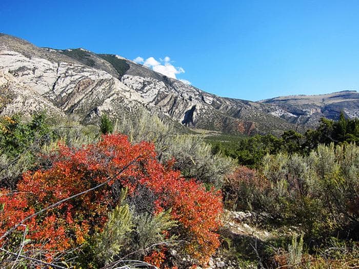
This highly scenic trail is suitable for hiking and horseback riding (advanced riders). Cottonwood Canyon has steep, vertical cliffs. The elevation at the mouth of the canyon is 4,800 feet with the top of the canyon wall at 7,200 feet. At the upper end of the trail, the elevation at the creek is 7,000 feet and the top of the canyon wall is 7,900 feet. The trail is about 4 1/2 miles long and winds through BLM-managed public land, Bighorn National Forest land and State of Wyoming land. The trail accesses the Bighorn National Forest where one can continue hiking or horseback riding on primitive roads and trails. Vegetation in Cottonwood Canyon include narrowleaf cottonwood, willow, waterbirch, red osier dogwood, big sagebrush, juniper, mountain mahogany, Rocky Mountain maple, Indian ricegrass, ninebark, limber pine, Douglas-fir, aspen, and bluebunch wheatgrass. Things to note: Bring drinking water as Cottonwood Creek disappears underground at times. If using water from the creek, filter it or otherwise treat before drinking.
Fee range
Fee unavailable
Season
Seasonal — contact for dates
Reservable
No
Sites available
Tent-focused
Amenities
Activities
Map & Nearby
Nearest town
Big Horn County, WY
Nearest major city
Denver, CO
~388 miles away
Weather
Weather — coming soon
Live forecast widget arriving in a future update.
Reviews
Be the first to review this campground. Reviews and saved lists arrive in Phase 2.